
Wednesday, May 23, 2018
09:00 - 10:30
5/23/2018 |
09:00 - 09:15
| 420 B
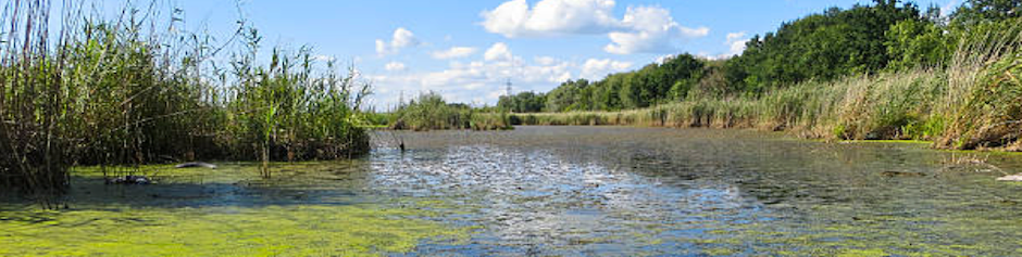
MACROINVERTEBRATE ASSEMBLAGE RESPONSE TO CONTAMINATED SEDIMENT REMEDIATION IN A LACUSTUARY SYSTEM
Degradation of benthos is a common beneficial use impairments (BUI) at Great Lakes Areas of Concern (AOCs), including the Maumee River, northeastern Ohio. Ottawa River is part of the Maumee River AOC, and has been altered by urban and industrial activities. Contaminated sediment was dredged from the Lower Ottawa River Lacustuary (LORL) in 2010. Lacustuaries are transition zones where rivers flow into lakes. Macroinvertebrate were collected with multi-plate samplers from remediation and control stations before (2007 and 2009) and after dredging (2010 to 2013 and 2015). Before-After Control-Impact analysis did not detect differences in Lacustuary Invertebrate Community Index (LICI) scores or individual metrics before and after the remediation between the control and remediation stations. A higher percent abundance of collector-gatherers at remediation stations than at control stations was detected across all years. The LICI scores along the LORL fluctuated between Very Poor and Poor status. The LORL remediation has, thus far, not had a positive or negative impact on the macroinvertebrate assemblages based on the LICI scores. Further efforts, such as removal of combined sewer overflows and restoration of physical habitat, may be needed to achieve the BUI restoration goal.
Ken Fritz (Primary Presenter/Author), US Environmental Protection Agency, Office of Research and Development, fritz.ken@epa.gov;
Jim Lazorchak (Co-Presenter/Co-Author), United States Environmental Protection Agency, Office of Research and Development, Center for Environmental Measurement and Modeling, Cincinnati, OH 45268, lazorchak.jim@epa.gov;
Marc Mills (Co-Presenter/Co-Author), United States Environmental Protection Agency, mills.marc@epa.gov;
William Thoeny (Co-Presenter/Co-Author), Pegasus Technical Services, thoeny.william@epa.gov;
Presentation:
This presentation has not yet been uploaded.
5/23/2018 |
09:15 - 09:30
| 420 B
THE WEIGHT OF EVIDENCE APPROACH TO DECISION-MAKING: EVALUATING BENTHOS IMPAIRMENT IN THE DETROIT RIVER AND ST. LAWRENCE RIVER AREAS OF CONCERN
Weight of evidence (WOE) approaches to aquatic ecosystem management, aggregate multiple lines of evidence to inform robust decision-making. The Canada-Ontario decision-making framework for assessment of Great Lakes contaminated sediment (CODMF), is a WOE approach aimed at examining the ecological impacts of legacy contaminants in sediments. Building on data collected over the past decade in relation to the Degradation of Benthos Beneficial Use Impairment (BUI) within the Detroit River and St. Lawrence River (Cornwall) Areas of Concern (AOCs), we employ the CODMF to evaluate the current status of each respective BUI. We evaluated each BUI based on benthic community structure, sediment chemistry and bioaccumulation. In both AOCs, hotspots of legacy sediment contaminants, including metals (mercury, arsenic and chromium), hydrocarbons and PCBs, were observed in excess of provincial effect levels. The WOE failed to connect sediment contamination to benthos community degradation. This provided the framework for recommending for the delisting of the Degradation of Benthos BUI within the Canadian waters of the Detroit River AOC. Conversely, limitations in the spatial availability of data available for the St. Lawrence River AOC, requires further monitoring in order to develop a more complete understanding.
Kerry McPhedran (Co-Presenter/Co-Author), University of Saskatchewan, kerry.mcphedran@usask.ca;
Ken Drouillard (Co-Presenter/Co-Author), University of Windsor, kgd@uwindsor.ca;
Mark MacDougall (Primary Presenter/Author), River Institute, mmacdougall@riverinstitute.ca;
Presentation:
This presentation has not yet been uploaded.
5/23/2018 |
09:30 - 09:45
| 420 B
INTERACTION OF RIVER FLOWS AND LAKE LEVEL FLUCTUATIONS ON WATER RESIDENCE TIME IN GREAT LAKES RIVERMOUTHS AND IMPLICATIONS FOR REHABILITATION
Rapidly fluctuating currents and water levels in Great Lakes rivermouths provide spatially unique and temporally complex habitats that are difficult to quantify. The residence time, or how long it takes a water particle to travel through a Great Lakes rivermouth, depends on the interaction of river flows with lake-level oscillations. Continuous velocity data from a U.S. Geological Survey index velocity station and synoptic velocity data from longitudinal transects were used in the development of an empirical model for mean daily water residence time for the lower Fox River Area of Concern, Wisconsin. Mean daily residence times from April through October 2016 ranged from about 10 to 80 hours. Frequent water-level oscillations, ranging from 4 to 10 times a day, caused reverse currents along the entire 12-km length, especially during low river inflows. A large seiche-related oscillation in September 2016 transported water more than 1 km upriver before reversing to the downriver direction. This approach can be applied in other Areas of Concern with USGS index velocity stations for quantifying how hydrodynamic conditions might influence the potential success of remediation activities related to removal of beneficial use impairments.
Faith A. Fitzpatrick (Primary Presenter/Author), U.S. Geological Survey, fafitzpa@usgs.gov;
Paul Reneau (Co-Presenter/Co-Author), US Geological Survey, pcreneau@usgs.gov;
Stephen Westenbroek (Co-Presenter/Co-Author), USGS, smwesten@usgs.gov;
James Blount (Co-Presenter/Co-Author), USGS, jblount@usgs.gov;
Presentation:
This presentation has not yet been uploaded.
09:45 - 10:00: / 420 B EFFECTS OF LAKE SEDIMENT STRUCTURE ON HEXAGENIA SPP. NYMPHAL DEVELOPMENT
5/23/2018 |
09:45 - 10:00
| 420 B
EFFECTS OF LAKE SEDIMENT STRUCTURE ON HEXAGENIA SPP. NYMPHAL DEVELOPMENT
Multiple anthropogenic disturbances to the Laurentian Great Lakes have had detrimental effects on benthic habitats and biota including the c1960 extirpation of the environmentally sensitive burrowing mayfly genus, Hexagenia, from Saginaw Bay, Lake Huron. Water quality improvements following remediation efforts, including those inspired by the Great Lakes Water Quality Agreement, haven't facilitated bay Hexagenia recovery as of 2012. Comparisons of bay sediment texture maps suggest suitable Hexagenia habitat has decreased, potentially limiting the species' recovery: while about half of the bay sediment contained >50% sand historically, in 2012 more than three-quarters contained >50% sand. To investigate Hexagenia's ability to develop on sediment with Saginaw Bay texture, ~5mo-old nymphs were reared for 60d at a density of 1/9cm2 on eight experimental sediment treatments (r=5, n=40). Treatments were constructed to contain 28%-98% sand in 10% increments, an approximation of the bay's 2012 sand level range. Nymphal survival, growth(cm), and adult emergence were documented. No significant differences among treatments were found. This suggests the current sediment texture of Saginaw Bay can support Hexagenia development, and thus other factors are responsible for its failure to recover.
Heather Siersma (Primary Presenter/Author), Wayne State University, heather.siersma@wayne.edu;
Donna Kashian (Co-Presenter/Co-Author), Wayne State University, dkashian@wayne.edu;
Presentation:
This presentation has not yet been uploaded.
5/23/2018 |
10:00 - 10:15
| 420 B
COMBINING COMMUNITY, TOXICITY, AND SEDIMENT CHEMISTRY ASSESSMENTS FOR BENTHOS EVALUATIONS AT TWO LAKE MICHIGAN AREAS OF CONCERN
In 2014, the U.S. Geological Survey (USGS) sampled communities of benthic invertebrates (benthos) at non-wadable sites in Great Lakes Areas of Concern (AOCs) and non-AOCs along Wisconsin’s Lake Michigan shoreline. Communities were assessed using relative abundance of taxa and biological metrics such as richness, diversity, and Index of Biotic Integrity. In fall 2016, the USGS collected composite samples of surficial sediment from 19 sites: 3 at the Sheboygan River AOC, 8 at the Milwaukee Estuary AOC, and 8 at non-AOC sites. Sediment was evaluated for toxicity (midge and amphipod) and chemistry (PCBs, polycyclic aromatic hydrocarbons [PAHs], metals, acid-volatile sulfide [AVS], and organic carbon). For 6 sites sampled in both 2014 and 2016, biological metrics for benthos correlated with metrics for toxicity and chemistry of sediments. Richness and diversity correlated negatively with bioavailable metals (normalized to AVS and organic carbon). Richness of combined (dredge and artificial substrate) community samples correlated negatively with sediment PAHs, bioavailable metals, and toxicity hazard rankings. These associations among benthic community metrics, toxicity tests, and sediment chemistry provide a robust characterization of the AOC sites with completed and ongoing remediation efforts.
Barbara Scudder Eikenberry (Primary Presenter/Author), U.S. Geological Survey, beikenberry@usgs.gov;
John Besser (Co-Presenter/Co-Author), U.S. Geological Survey, jbesser@usgs.gov;
Hayley Olds (Co-Presenter/Co-Author), U.S. Geological Survey, htolds@usgs.gov;
Emily Bernhardt (Co-Presenter/Co-Author), U.S. Geological Survey, rdorman@usgs.gov ;
Presentation:
This presentation has not yet been uploaded.
5/23/2018 |
10:15 - 10:30
| 420 B
BREAKING BARRIERS: LEGACY PHOSPHORUS MONITORING DURING RESTORATION AND BERM REMOVAL FOR HYDROLOGIC RECONNECTION OF FLOODED AGRICULTURAL FIELDS TO THE WATERSHED
Bear Creek is the major tributary of Bear Lake, which is part of the Muskegon Lake Area of Concern (AOC). Excess nutrient concentrations and wetland habitat loss are two beneficial use impairments still in need of remediation. Two flooded former agricultural muck fields, now serving as flooded ponds and separated from Bear Creek by earthen berms, were identified for wetland restoration and hydrologic reconnection to Bear Creek to increase AOC wetland acreage. Pond sediment was dredged before reconnection to minimize release of sequestered legacy sediment P.
We monitored Bear Creek and the ponds before and after dredging and berm removal. Post-restoration Bear Creek soluble reactive P concentrations were lower downstream of ponds than upstream and total phosphorus (TP) concentrations in one pond were reduced to ~3% of pre-restoration means; however, post-restoration TP values occasionally exceeded Bear Lake’s total maximum daily load goal of 30 µg P/L. Sediment isotherm and porewater analyses indicate although sediment P concentrations have been greatly reduced, the former ponds remain sources of P to the water column. These results build upon previous research promoting dredging as one potential tool for reducing sediment P loads from wetlands.
Michael Hassett (Primary Presenter/Author), Annis Water Resources Institute - Grand Valley State University, hassetmi@gvsu.edu;
Maggie Oudsema (Co-Presenter/Co-Author), Grand Valley State University - Annis Water Resources Institute, oudsemam@gvsu.edu;
Kim Oldenborg (Co-Presenter/Co-Author), Annis Water Resources Institute-Grand Valley State University , oldenbok@mail.gvsu.edu;
Alan Steinman (Co-Presenter/Co-Author), Annis Water Resources Institute-Grand Valley State University, steinmaa@gvsu.edu;
Presentation:
This presentation has not yet been uploaded.